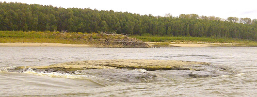
Navigation Links

Redirecting...

Rock Pinnacles


All navigation interests are advised that special purpose electronic chart overlays for rock pinnacles that are obstructing a 9-foot navigation channel between Upper Mississippi River miles 46 & 38 have been posted to the USACE Army Geospatial Center website.

The special purpose overlay files are referenced to the Thebes gage, located at mile 43.7 UMR, and the appropriate overlay file should be selected that relates to the reading of the Thebes gage or lower. A separate file is available for a Thebes gage reading of 7, 6, 5, 4, 3, 2, 1, and 0-ft on the gage. For example, the overlay file for a Thebes gage reading of 5 will show rock pinnacle locations that will be hazardous for 9-ft navigation at the Thebes gage reading between 5.9 and 5.0-ft.

S-57 overlay files have also been created for buoy locations for the Thebes reach. These locations are constantly changing with the stages on the river therefore they are intended to be used for reference and not as navigation guides.

All of the overlay files are in S-57 format and should be readable by most commerical electronic navigation software. The special purpose overlay files are available at the IENC Downloads page under the "Special Purpose S-57 Channel Condition Overlays" section. *Note: Once on this page please select "Special Purpose Channel Condition Overlays", this will expand to show all of the available overlay files.

 Rock Pinnacles UMR 46-38: Thebes

The following PDFs have been created for viewing the rock pinnacles without using commerical electronic navigation software. These PDFs reflect gage readings at Thebes and Grand Tower for Upper Mississippi River Miles 46-38.

Thebes Gage UMR 43.7
USACE Gage Reading
Gage Name
Gage Reading
PDF
Channel Alignment
Thebes 7.9 to 7.0ft Thebes at 7  
Thebes 6.9 to 6.0ft Thebes at 6  
Thebes 5.9 to 5.0ft Thebes at 5  
Thebes 4.9 to 4.0ft Thebes at 4  
Thebes 3.9 to 3.0ft Thebes at 3 Thebes at 3
Thebes 2.9 to 2.0ft Thebes at 2 Thebes at 2
Thebes 1.9 to 1.0ft Thebes at 1 Thebes at 1
Thebes 0.9 to 0ft Thebes at 0 Thebes at 0

The following xyz data are results of surveys made on the dates indicated and they can only be considered the general conditions existing at that specific point in time. The data represents horizontal and vertical data collected between the navigational buoys on the date of the survey. The "xy" data is projected in the State Plane NAD-27 Coordinate System (Missouri East) and the "z" elevation data is referenced to the NGVD 29 vertical datum. All users of this data are urged to use extreme caution when using this data to calculate depths at various stages. Inconsistencies and inaccuracies may be caused by variable and changeable water surface slopes, interpolation between river gages, sensor and river gage accuracy and other associated issues.

Thebes Reach XYZ Data
River Mile
XYZ Data
38 to 39 Download (17 OCT 2012)
39 to 40 Download (22 OCT 2012)
40 to 41 Download (15 OCT 2012)
41 to 42 Download (17 OCT 2012)
42 to 43 Download (17 OCT 2012)
43 to 44 Download (16 OCT 2012)
44 to 45 Download (16 OCT 2012)
45 to 46.5 Download (16 OCT 2012)

Rock Pinnacle Depths at Thebes : the minimum depth (within the noted estimated accuracy range) for each box at the listed gage readings at Thebes. The depths were generated only for the highest priority rock removal box locations. They do NOT represent the only navigation hazards potentially in the reach shown - these maps are intended only to provide additional information for specific survey locations.

Thebes Elevation Imagery : the imagery shows bed elevation through Thebes collected using multibeam sonar survey equipment in October 2012. The elevation data are shown facing downstream.

 Rock Pinnacles UMR 80-78: Grand Tower

The following PDFs have been created for viewing the rock pinnacles without using commerical electronic navigation software. These PDFs reflect gage readings at Thebes and Grand Tower for Upper Mississippi River Miles 80-78.

Grand Tower Gage UMR 81.9
USACE Gage Reading

(These have been updated based on newer hydrographic surveys from 2012)
Gage Name
Gage Reading
PDF
Channel Alignment
Grand Tower 3.3 to 2.4ft Grand Tower at 2.4  
Grand Tower 2.3 to 1.4ft Grand Tower at 1.4 Grand Tower at 1.4
Grand Tower 1.3 to 0.4ft Grand Tower at 0.4 Grand Tower at 0.4
Grand Tower 0.3 to -0.6ft Grand Tower at -0.6 Grand Tower at -0.6

Rock Pinnacle Depths at Grand Tower : the minimum depth (within the noted estimated accuracy range) for each box at the listed gage readings at Thebes. The depths were generated only for the highest priority rock removal box locations. They do NOT represent the only navigation hazards potentially in the reach shown - these maps are intended only to provide additional information for specific survey locations.

 Low Water Navigation Meeting St. Louis 20 NOV 12

Presentations and documents from the Low Water Navigation Meeting in St. Louis on 20 NOV 12 are provided below. Please select the hyperlink to access the document.

Farhat Presentation: by Jody Farhat, PE, explaining the operation of the Missouri River reservoirs and the effects operations both in the near-term and into next year will have on water supply into the Mississippi River.

USACE Water Control Presentation : by Joan Stemler (USACE) providing an overview of the district's water management, operations of the L&Ds, removal of stage fluctuations using Mel Price pool, forecasts for district gages, what can be done with STL reservoirs to assist, and an explanation of LWRP.

Rock Removal Presenation : by Mike Rodgers (USACE) providing an overview of district plans for upcoming rock removal.

Water Action Plan : by Captain Teschendorf (USCG) outlining the Coast Guard and other team member responses to low water conditions.