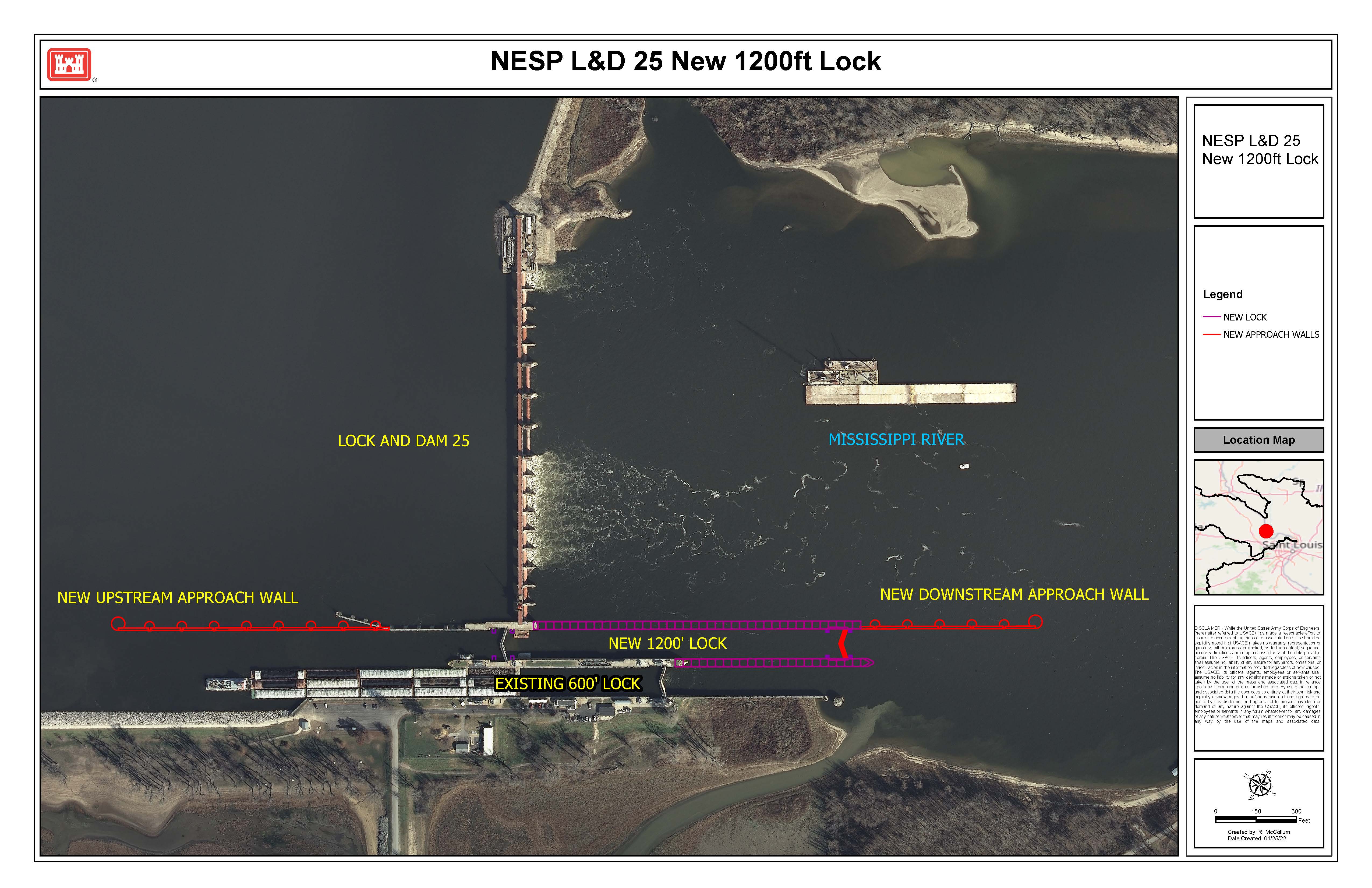
Lock and Dam 25 is located in Calhoun County, Illinois, and Lincoln County, Missouri, at mile 241.4 on the Upper Mississippi River near Winfield, Missouri.
Proposed project features include construction of new 1,200-foot, pile founded, lock located in the auxiliary miter gate bay, and construction of an upstream, ported guard wall totaling 1,200 feet, and a 650-foot downstream approach wall. The existing 600-foot lock remains in place and will become auxiliary lock chamber to be used primarily by recreation traffic. The project also includes associated channel work, relocations and site-specific environmental mitigation.
The majority of the Upper Mississippi River locks were designed and constructed in the 1930’s and the lock chambers are 600-ft. long. The 600-foot. lock chamber cause significant average delays to navigation because of double lockages required for tows larger than 600-foot. The new 1,200-foot lock will significantly reduce delays and increase safety.
The combination of ecosystem and navigation in a single U.S. Army Corps of Engineers program required many years of coordination with both the navigation and ecosystem partners and it will alter the future of the Upper Mississippi River System to ensure it remains the vital transportation and ecosystem corridor for the next 100 plus years.