Navigation Links

Redirecting...

Dredge & Channel Maintenance


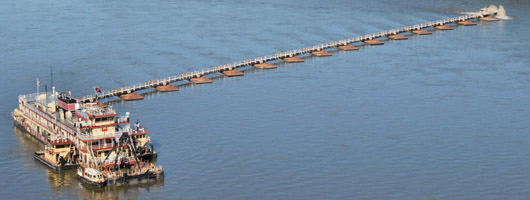
One of the missions of the St. Louis District U.S. Army Corps of Engineers is to maintain a 9 foot navigable channel on the Upper Mississippi River from river mile 0.0 (confluence of the Ohio) to river mile 300.0 (below Lock and Dam 22), the lower 80.0 miles of the Illinois River and on the Kaskaskia River from Fayetteville, Illinois to the Mississippi River. This mission is accomplished by several methods.

In the Dredging Operations program the first method is to use the Channel Patrol Boat PATHFINDER to identify possible dredging locations by performing channel reconnaissance surveys. The Pathfinder also assists the Coast Guard with buoy positioning on the navigable waterways within the St. Louis District Boundaries.

Another method utilized by our Engineering Hydraulics Branch is to design and construct structures in the river that maintain sufficient depths in the waterway. To find more information on river structures follow this link: Applied River Engineering Center.

Whatever the case, dredging is the last method for providing a navigable channel.

 What is a Dredge?

Dredging in the St. Louis district is accomplished by using hydraulic pipeline dredges. A hydraulic dredge mixes large quantities of water with the excavated material (almost always sand in the St. Louis District) to create a slurry which is then pumped out of the navigable channel. The two types of hydraulic pipeline dredges used by St. Louis are the "Dustpan" and the "Cutterhead."


The Dustpan Dredge was specifically designed by the Army Corps of Engineers for work on the Mississippi River. The Dustpan is very efficient in excavating sand material from the river bottom. Water jets at the end of the suction head agitate the sand into a slurry which is then pumped up into the dredge. The slurry is then transferred 800 feet via a pipelined and discharged outside of the navigable channel.

A Cutterhead Dredge has an active rotating auger surrounding the suction line. The material is pumped up to the dredge and discharged through a pipeline up to 3000 feet away. Farther distances are possible with additional pipeline and booster pumps. Dredging is coordinated with other Government Agencies so that our operations are conducted in an environmentally sensitive manner. In fact, we area always seeking ways to promote positive contributions to the environment such as island creation and beach nourishment.
 Navigation On The Open River

The combined waters of the Missouri and Mississippi Rivers typically assure adequate depths for navigation, except for periods of prolonged drought. Still, much effort is needed to facilitate navigation in the open river, usually in the form of maintenance dredging and regulating works. Maintenance dredging operations involve the repetitive removal of naturally deposited sediment from the navigation channel.


The St. Louis District Applied River Engineering Center uses table-top “micro-models” to develop innovative solutions to various sedimentation problems. More often than not, these solutions are found in what we call “regulating works”. Regulating works are structural designs, such as chevron dikes, bendway weirs, off-bankline revetments, and notched dikes. By necessity, our river engineers seeks to implement structural designs that work in harmony with the natural laws of the river to solve problems involving sedimentation, erosion and biological diversity, all while providing a safe and dependable navigation channel.